Some examples of our work.

Downtown Los Angeles
Fashion District

Sydney, Australia
We were told that Location Maps in Australia are two pagers; one for the drawing, and one for the directions. Also, in New Zealand “Location Maps” are called “Mud Maps,” which is fantastic.

Nassau, The Bahamas
Hands down one of the most challenging maps we’ve ever made, as nearly all roads on Nassau are without street signs. For crew accustomed to looking for street signs the hope was that providing exact distances would help, however The Bahamas is on the metric system so that had to be addressed too.
Somehow the movie did get made and was released.

Trang An River, Vietnam
The one thing that will limit us from being able to provide a map is if the language the street signs are written in isn’t a Latin or Cyrillic alphabet. Learning that Vietnam did in fact use a Latin based alphabet made this doable.
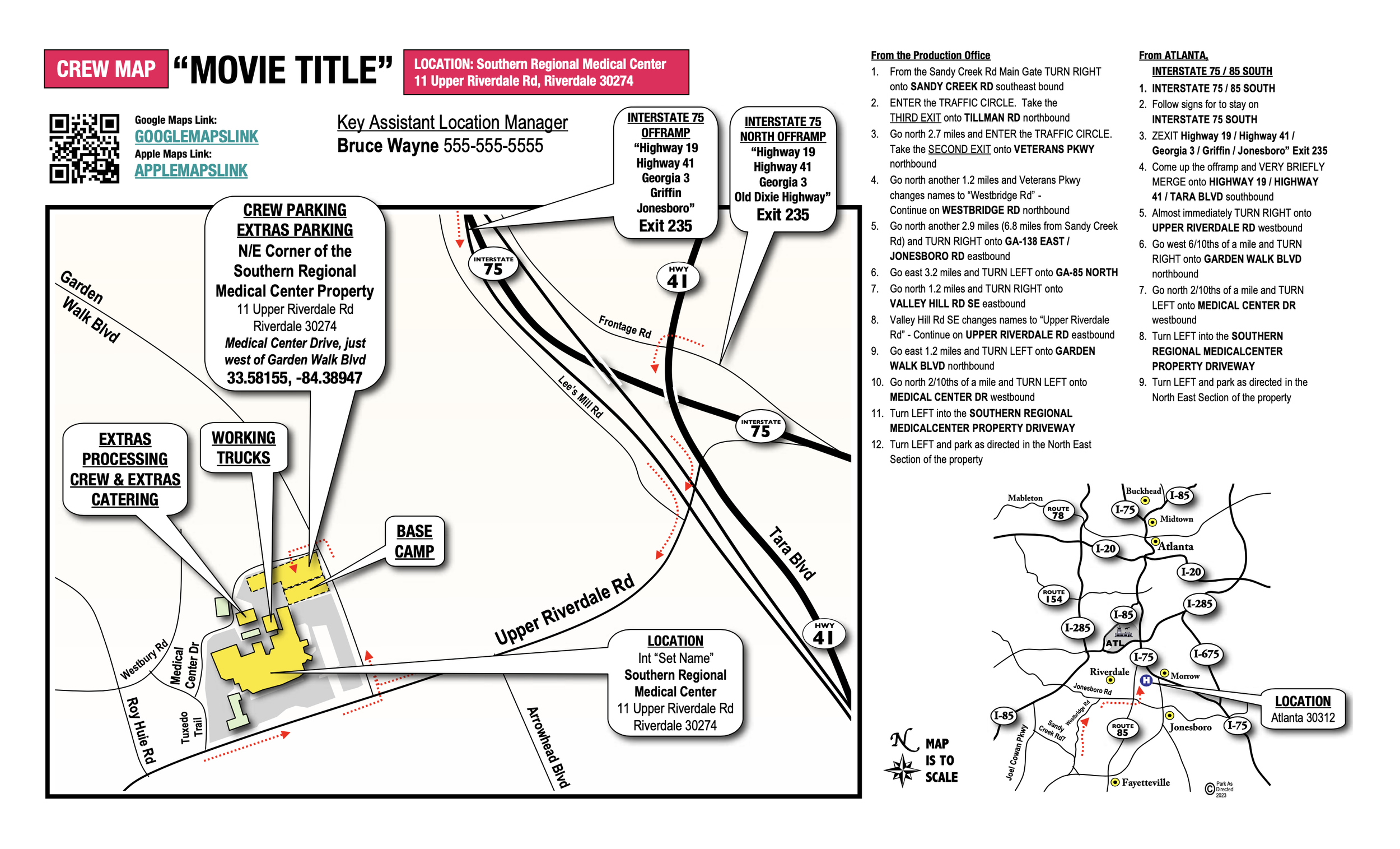
Riverdale, Georgia
Just a bit south of Atlanta. Exetremly Popular

Brooklyn, New York
Iconic neighborhood. It’s always fun trying to remind myself how the trolley system works in New York City so we can provide the correct closest Subway Station.

Honolulu, Hawaii
Quietly one of the busiest urban areas in terms of filming in the United States.

Austin, Texas
One of the nice things about mapping Texas is how spread out most shows are.

Manhattan, New York
Houston Street, in Manhattan, has got to be the most mispronounced street name in the world.

Miami, Florida
Bridges + one way streets make getting to crew parking an adventure.
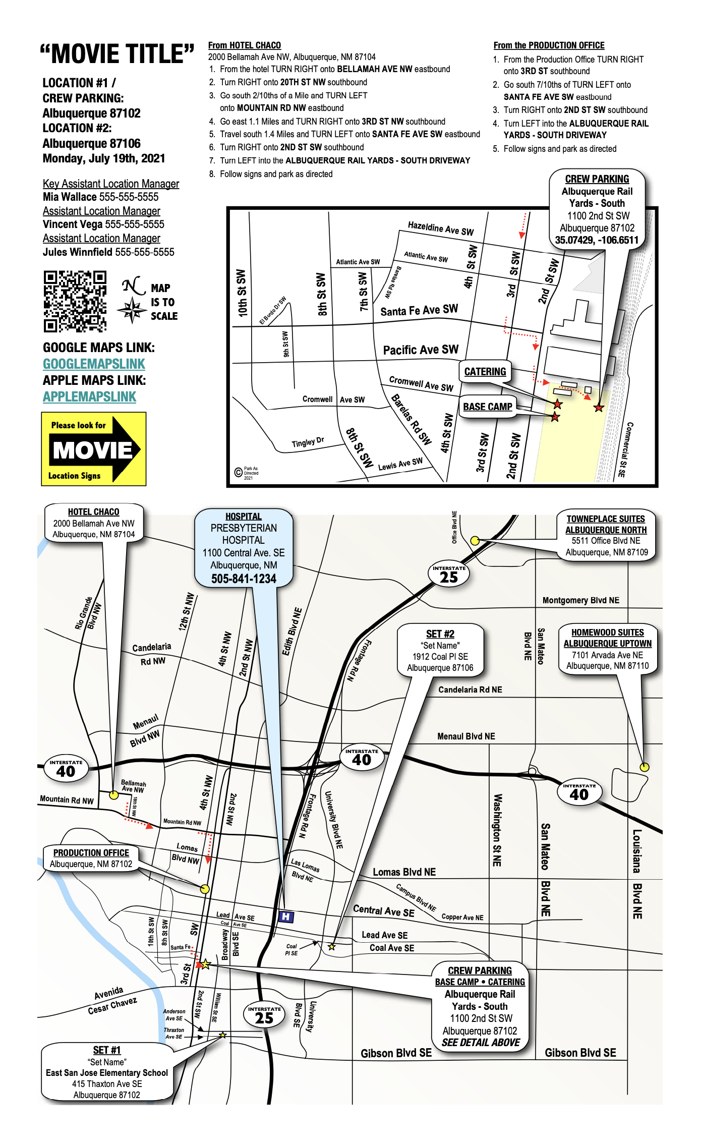
Albuquerque, New Mexico
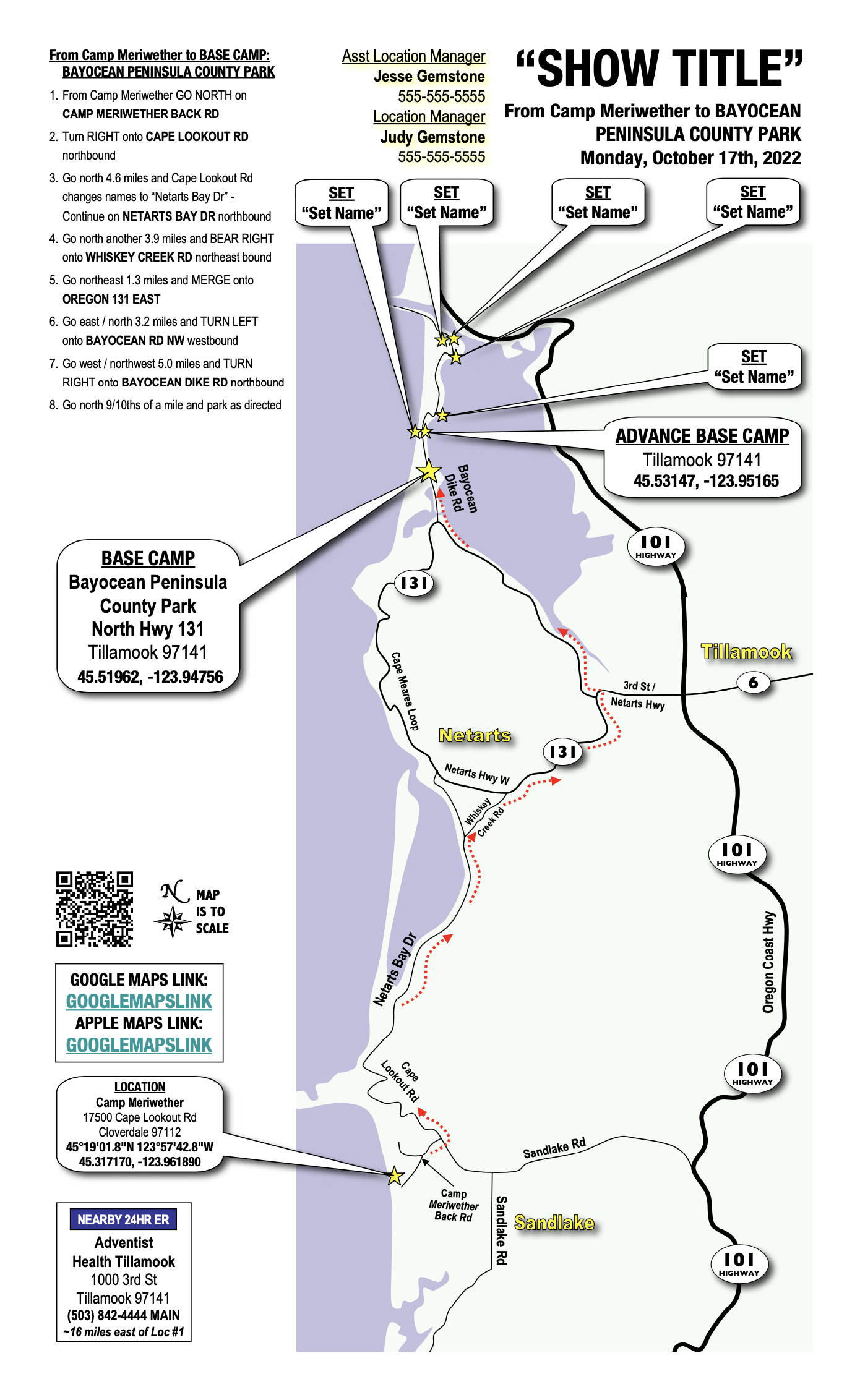
Tillamook, Oregon

San Francisco, California
Apparently Mark Twain did NOT write “The coldest winter I ever spent was summer in San Francisco.”

Maalaea Harbor, Maui, Hawaii
Although we will always strive to create the most concise, clean, and professional design that 20 years of experience can muster, some destinations require pushing the limits of our artistic abilities.
~14 miles south of Cleveland, Utah
The specs on this map pushed boundaries. In order to get from the town where the hotels were, to where the Crew Parking was located, crew would have to travel roughly 33 miles on remote, small, and mostly dirt roads, mostly unsigned, and in areas without cell phone reception. The bigger struggle was going to be heading out after wrap, in the dark. So, we found and labeled waypoints on the map.

Boston, Massachusetts
Downtown Boston. One Way Streets, tons of traffic, and an enormous production.

Dallas, Texas
Convention Center, Downtown Dallas

Denver, Colorado

Detroit, Michigan

Florida Keys

Grand Rapids, Michigan

Las Vegas, Nevada
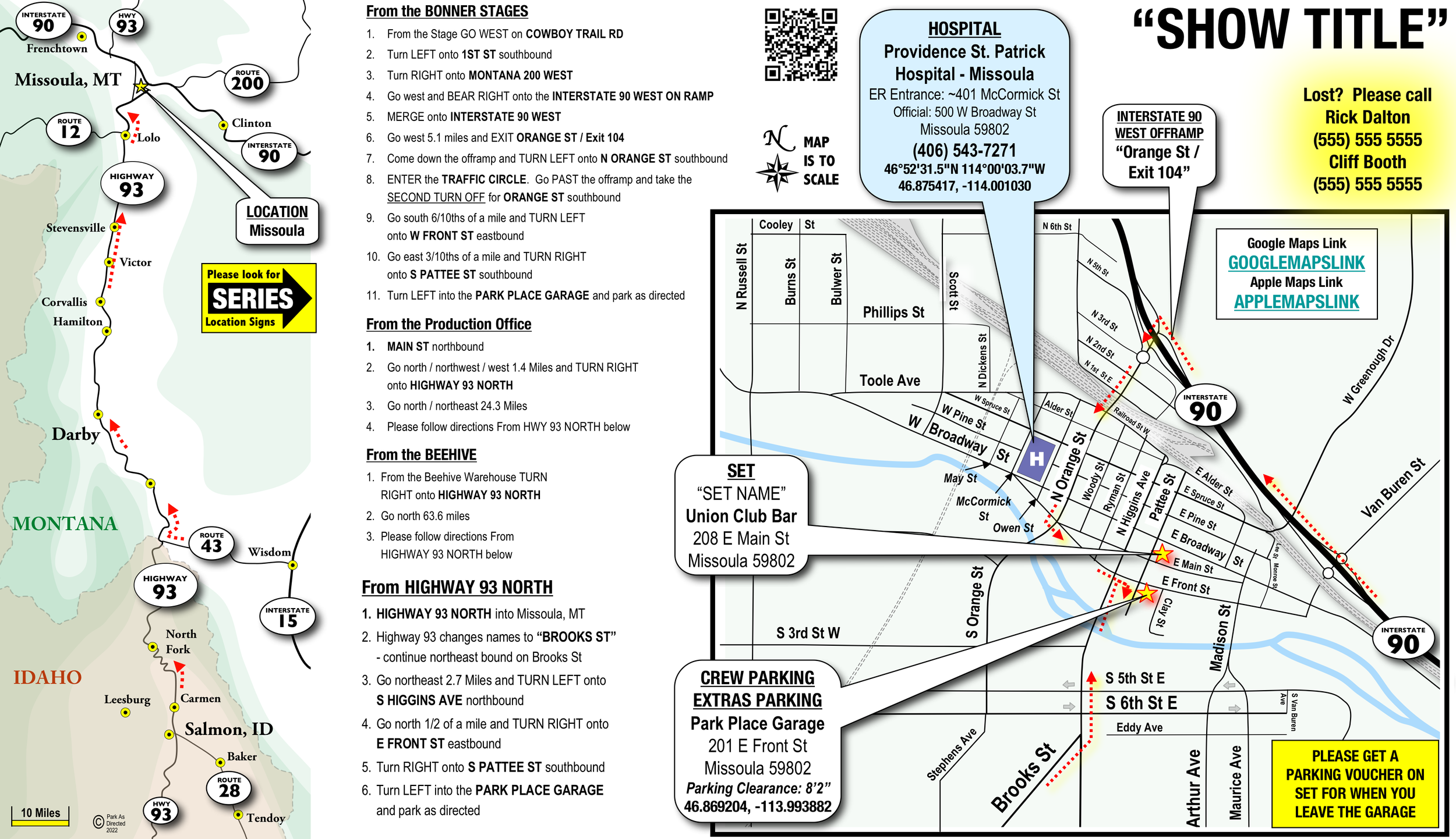
Missoula, Montana

Nashville, Tennessee
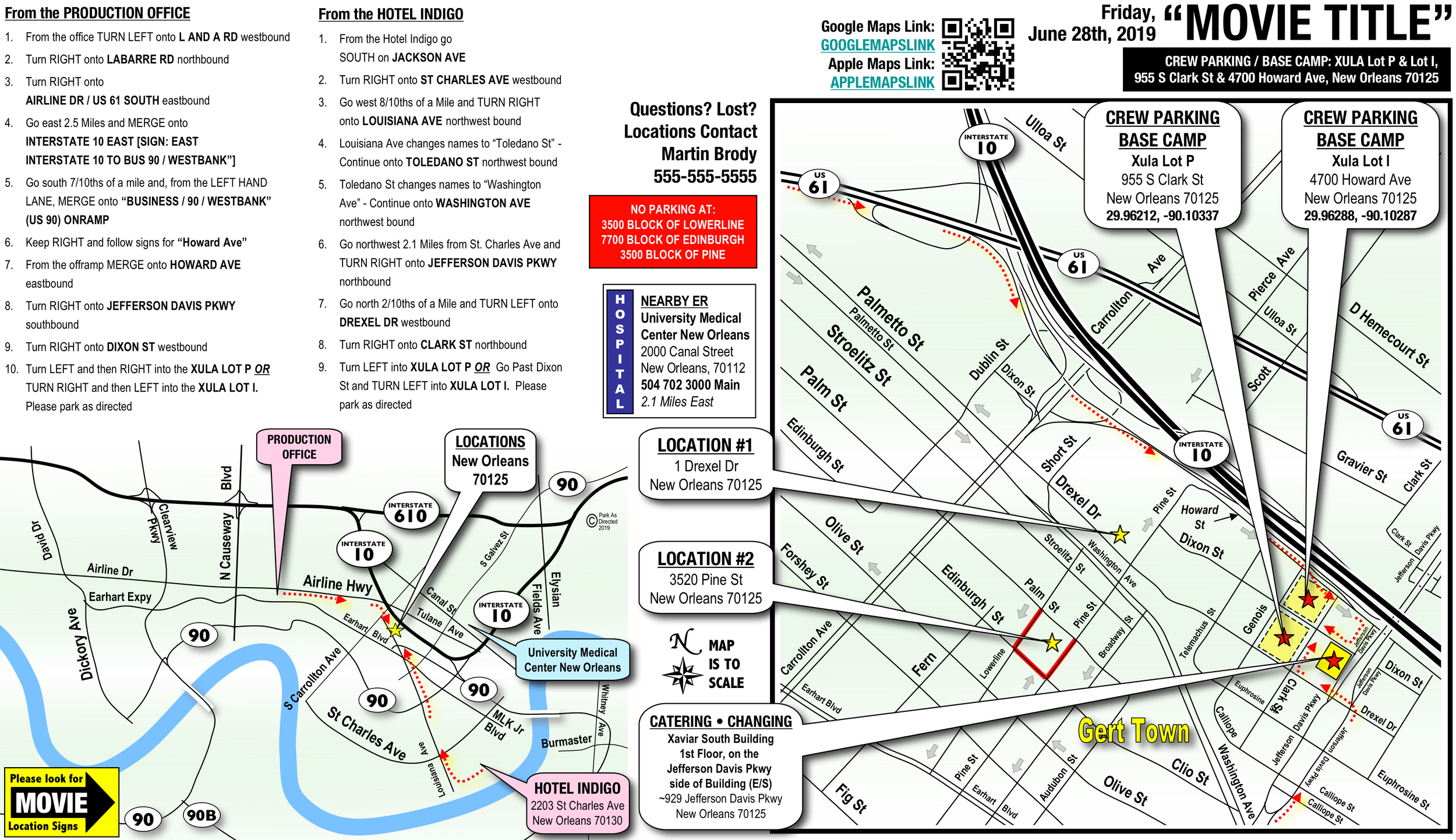
New Orleans, Louisiana

Tulsa, Oklahoma

Orlando, Florida

Page, Arizona
South of Lake Powell, adjacent to Horseshoe Bend.

Petoskey, Michigan
Upper Peninsula

Pittsburgh, Pennsylvania
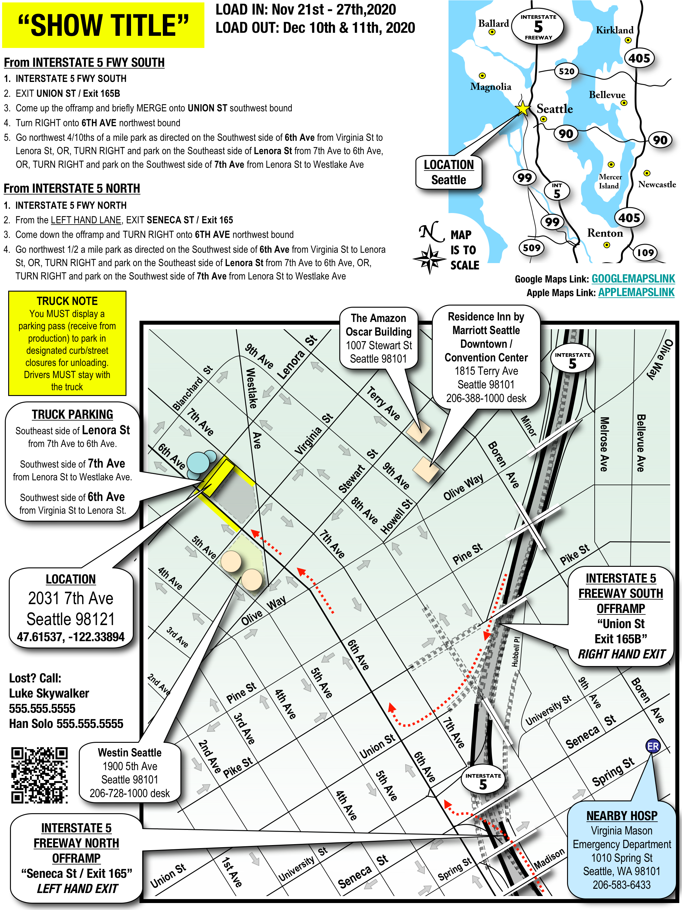
Seattle, Washington

Charleston, North Carolina

Tucson, Arizona
Tricky map. Filming was scheduled adjacent to a large music festival.

Washington D.C.
Diagram showing Transpo specific points.
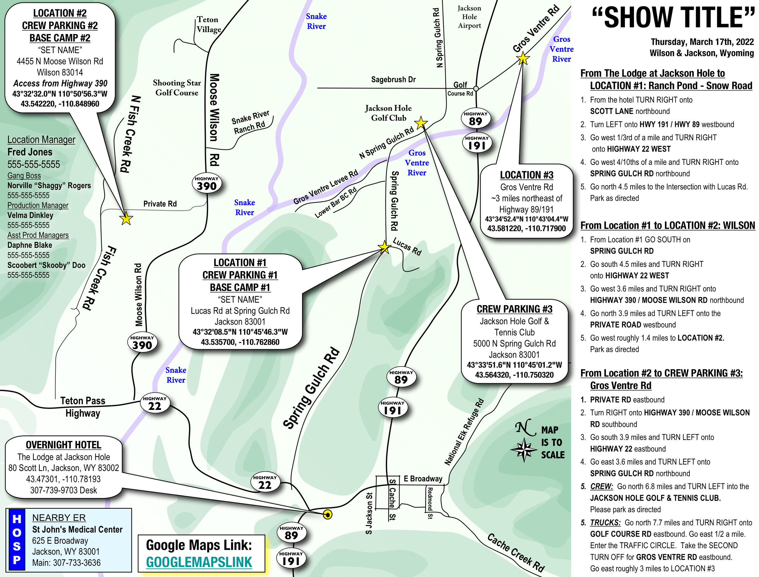
Jackson and Wilson, Wyoming